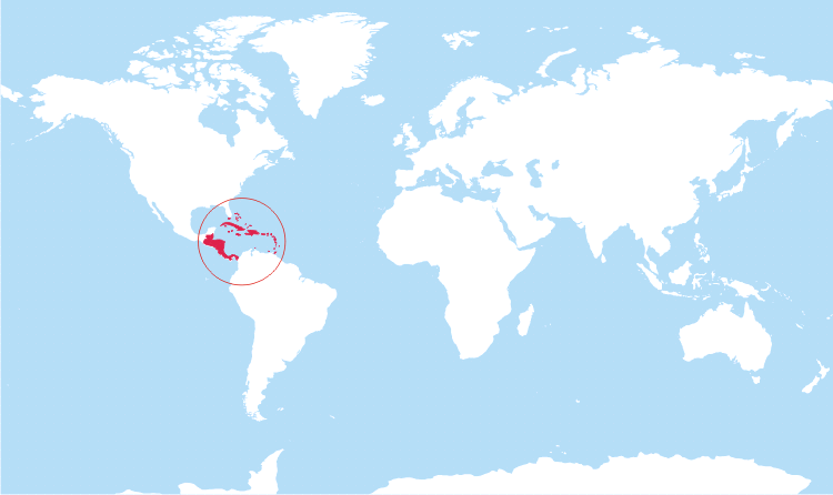
Central America is in North America
As is the Caribbean.
FWIW I grew up in Central America and we didn’t consider it part of North America.
I mean, if a geology teacher said it was, we’d write it down on the test that it was, but no-one thought of it that way.
Interesting, so North America was just the US and Canada to you?
Latinoamerica divides up the Americas by ethnicity. North America is USA and Canada, Jamaica, the Bahamas, Trinidad & Tobago, Miami (lol), Saint Lucia, Dominca, US Virgin Islands, and other Anglosphere Antilles. The rest is Latinoamerica, including Puerto Rico (US) and Brazil (Portuguese ancestry).
Fun fact: there is a considerable portion of Latinoamerica that refuses to call people from the USA “Americans”, and instead call them United Statians (Estado Unidenses) or North Americans (Norteamericanos). This is because they see everyone from the Americas as Americans, so calling people from the US Americans kind of implies that everyone else isn’t American. This trend is more common in Latin American countries that have had an antagonized relationship with the US, especially in the 1900s during the Kissinger years.
Funner fact: In general, French Guiana and Haiti get grouped in with Latinoamerica, but not Quebec or Louisiana. I don’t know about Martinique and Guadeloupe, but my guess is that they would.
Funnest fact: Lots of people in Cuba don’t even use United Statesians or North Americans as identifiers. Instead, they call Americans “Yuma” after an American movie called 3:10 to Yuma where the part of the plot was to reach Yuma, AZ.
Makes sense (except the Yuma part).
ALL AMERICA IS FREE AMERICA. IF IT AINT FREE, IT AINT ME. 🦅🦅🦅🦅🦅🍔🍔🍔
Central America is not a continent. It’s a region of North America. This is ridiculous claim.
We’re reaching a point where I am questioning the ratio of quantity versus quality in OP’s posts. I still appreciate how active they are, and they have a large number of good posts
You trippin, @Don_Dickle@lemmy.world I appreciate you! (edit: this came out sounding harsher than I meant, and I apologized through DM.)
I literally said I appreciate them
Resolved: @Don_Dickle@lemmy.world is appreciated!
Just as a data point, when I was a kid, norteamericano meant someone from the US.
Yeah but brown people
As others have pointed out:


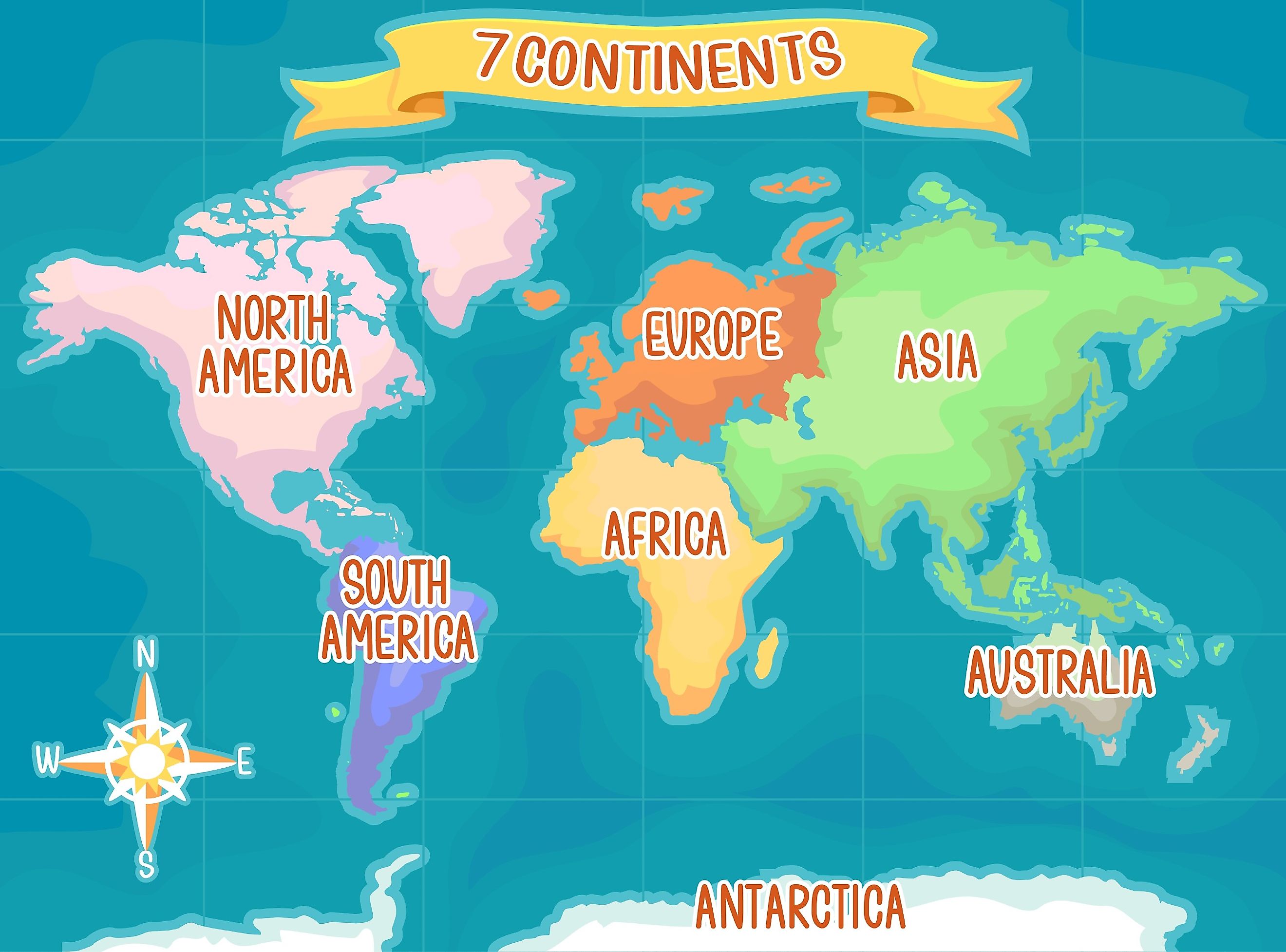
That map says that New Zealand is part of the continent of Australia, which it is not. New Zealand is on a submerged continent called Zealandia
Continent are fairly subjective. Some favor strictly connected lands (joining Eurasia). Others do it by the tectonic plates. Other by culture barriers drawing a line between Europe and Asia.
For the purposes of the post I simply meant to convey that the NA v SA distinction is widely accepted to be at the thinnest point between them. Which would include Central America w/ NA.
Right, but on an article clarifying the often misunderstood continental boundaries, I thought it might be helpful to point out that map was creating more of that confusion in a different area, whilst clarifying it for another
At least New Zealand’s on this map. :)
Zealandia (pronounced /ziːˈlændiə/), also known as Te Riu-a-Māui (Māori)[2] or Tasmantis (from Tasman Sea),[3][4] is an almost entirely submerged mass of continental crust in Oceania that subsided after breaking away from Gondwana 83–79 million years ago.[5] It has been described variously as a submerged continent, continental fragment, and microcontinent.[6] The name and concept for Zealandia was proposed by Bruce Luyendyk in 1995,[7] and satellite imagery shows it to be almost the size of Australia.[8] A 2021 study suggests Zealandia is over a billion years old, about twice as old as geologists previously thought.[9][10]
deleted by creator
I blame that crack.com article that came out like 15 or 20 years ago or whatever it was. One of the worst and most poorly research articles I’ve ever read and yet it’s spawned a legion of terrible responses.
My man read the first paragraph of the Wikipedia article and came straight here to post
Buddy said “No! This is like, PRESS CONFERENCE level stuff!” and hit Post
I’m most fascinated by the route map: it explains why he never set for on the continent. He took the long way. I suppose there was no reason to expect a great circle route but that so engrained that I couldnt picture him getting to the Caribbean without going down the east coast
Especially if you consider Columbus’ voyages together with Eric the Red, a great circle route just seems automatic
Put that together with safe flying rules where you don’t want to go too far from land, depending on your plane, so naturally follow the coast, then cross the ocean where it’s narrower and there are places to land. Why wouldn’t an old sailing ship also want to stay near land?


