- 646 Posts
- 159 Comments

 7·6 days ago
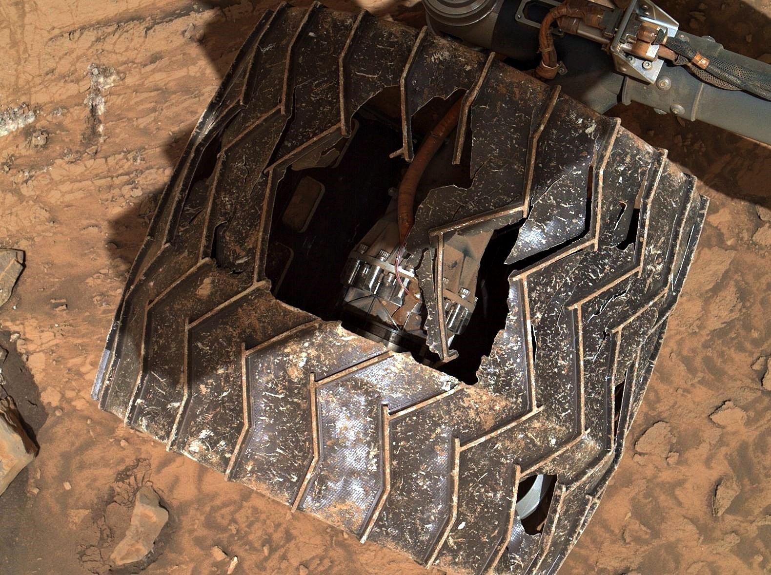
why isn’t the wheel solid?
- Weight is an issue
- The wheels were the rover shock absorbers during landing (by the sky-crane back in 2012)
- Yes, no passenger comfort, but there is an amount of sensitive electronics and instruments to protect.
Several years ago they did an engineering study that basically stated that when a specific number of cleats broke it had used up a percentage of its life. We’re past that stage now. They have since developed a scenario that will allow them to rip one half of the damaged wheel off, and still drive on the remaining half… All of the wheels are motorized, losing one wheel won’t stop the rover from traversing to it’s science waypoints
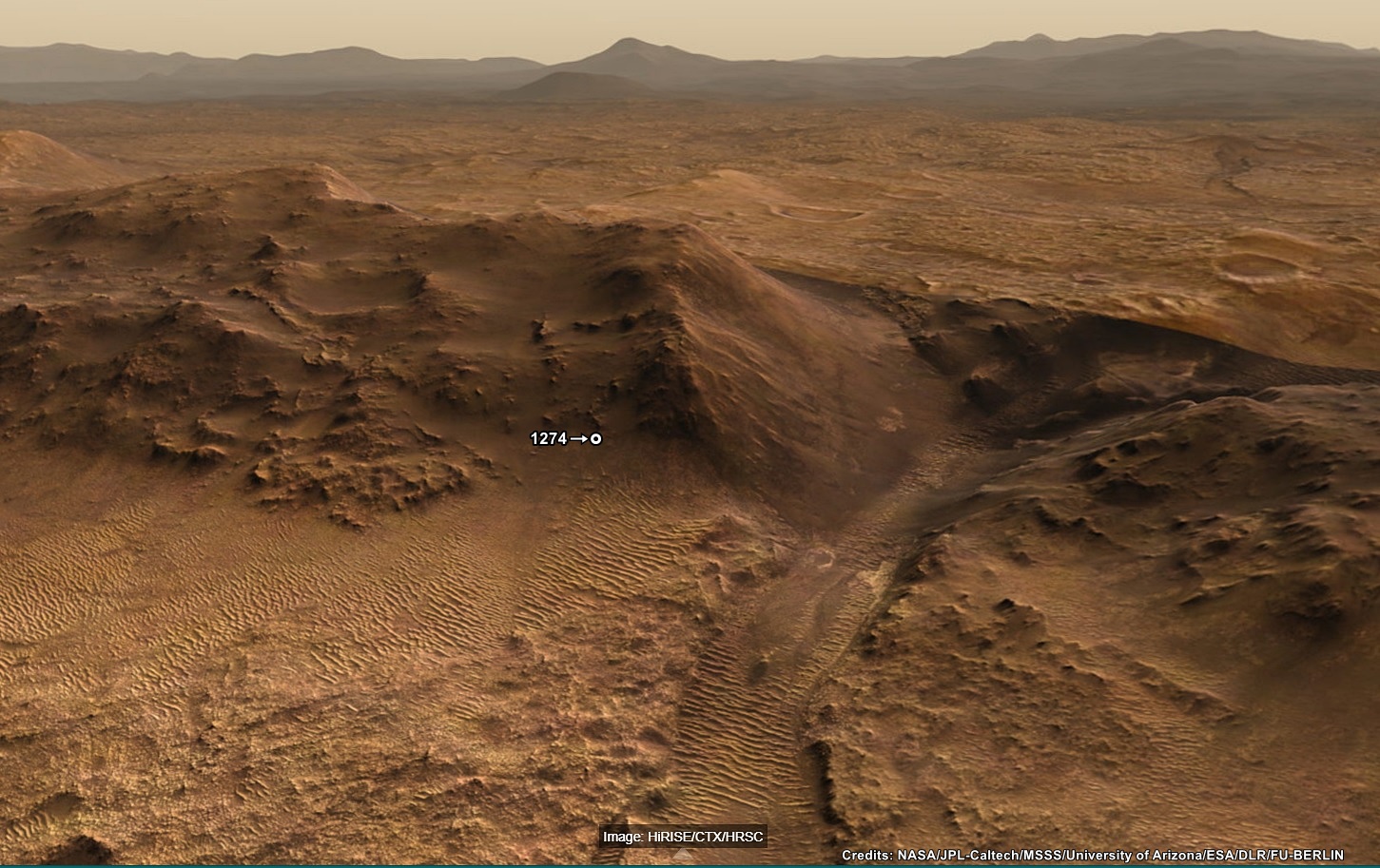
 3·9 days ago
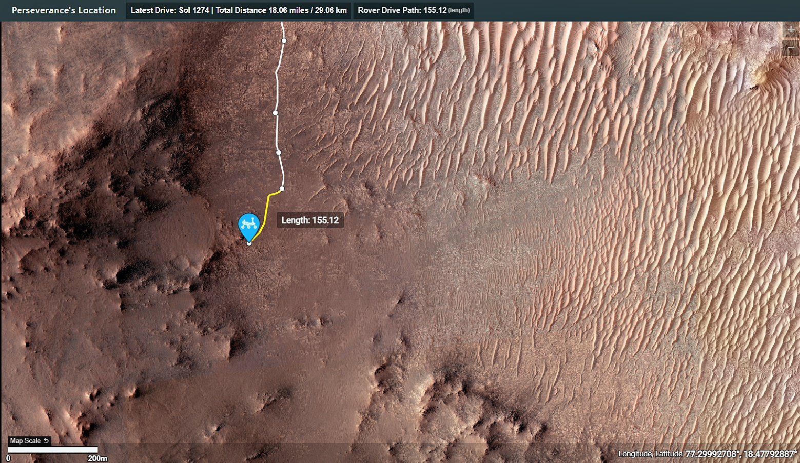
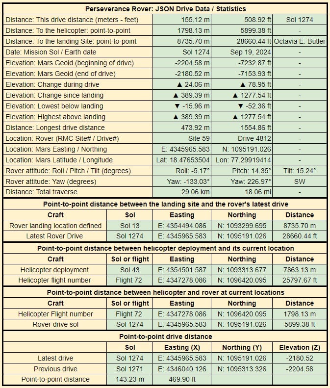
It was, the climb on 1274 currently holds second place on the leader board, the highest elevation climb in a single drive is currently 26.4 meters (sol 1268), but that was over a marginally longer traverse, so probably a very similar average angle. I agree that the team have appeared to pause the drives whenever they spot an enticing target of opportunity :)
Pity we don’t get frequent and detailed mission updates (Like we get on MSL). The PDS mission manager reports are amazing, but they are only made public at least 6 months after the ‘event’
I’d like to hope so. One could assume that it would be a prerequisite to any crewed missions, so fingers crossed for a high-speed / volume DSN in my lifetime ☺️
That’s the one 🤣🤣🤣
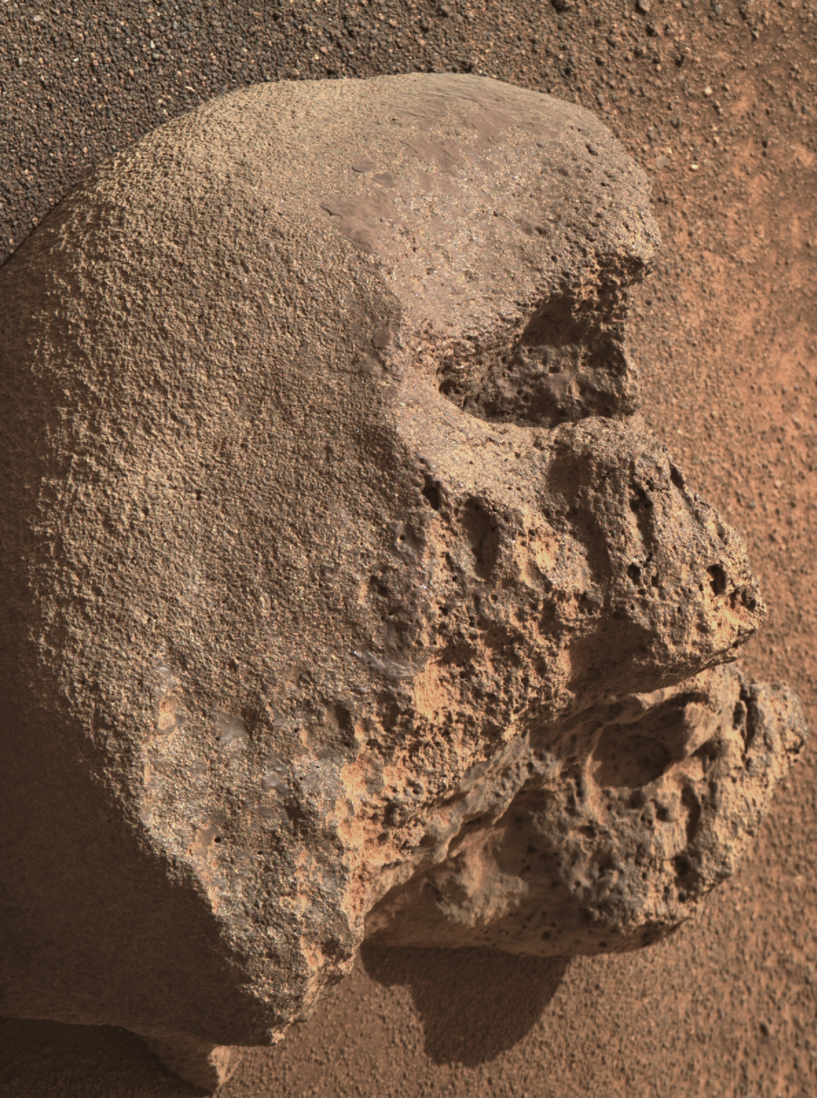
Looking at the camera elevation and the 110mm zoom, I’d have to assume it was a very small
skullrock on Mars ;)

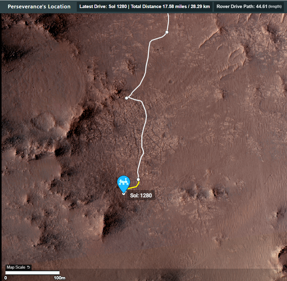
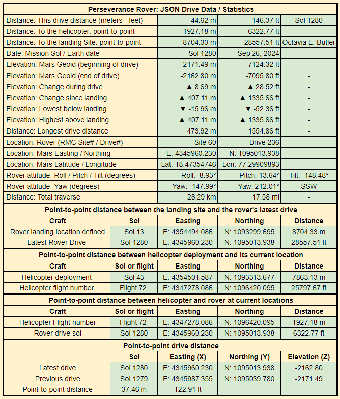
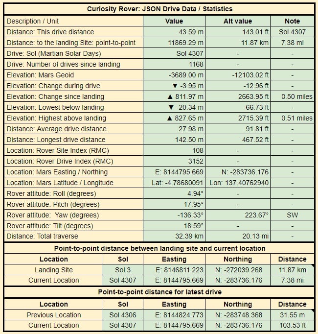
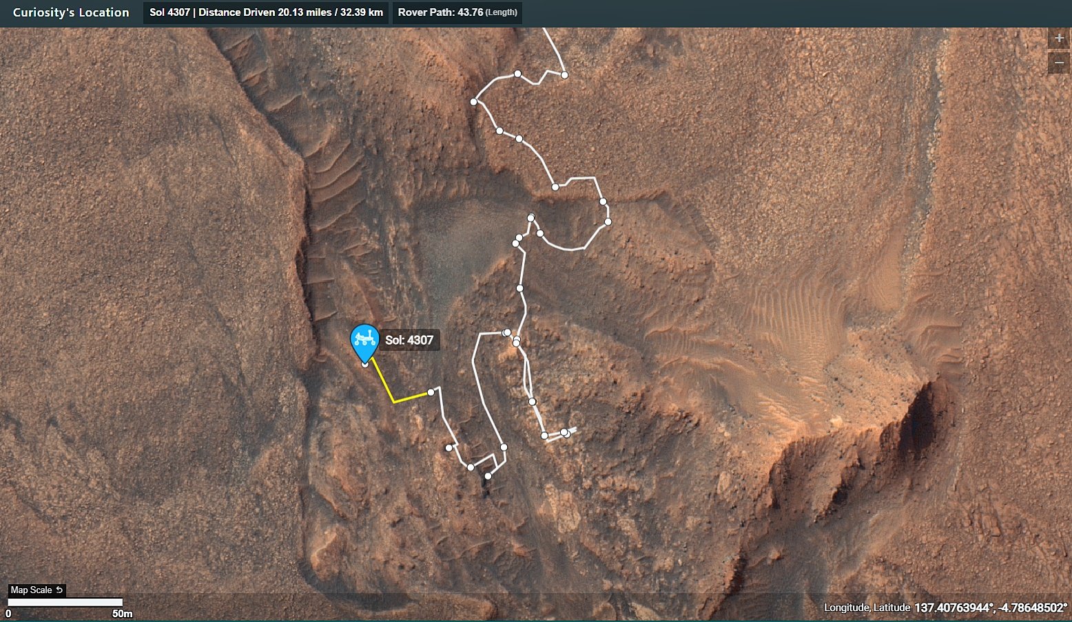
The public can access the mission map on this URL. It is updated by the mission team after each drive https://mars.nasa.gov/maps/location/?mission=Curiosity
I would hope they do a mix of “old world” and ‘new’ world names 😁
The dump is a text file i’ve updated as the mission progressed. Saves me time when I get asked the question re place names.
It’s a naming convention.
Curiosity is currently in the “Bishop” map quadrangle. “Tungsten Hills” rocks, were named after a famous mining district near Bishop, California.
It was mentioned in this mission update https://science.nasa.gov/blog/sols-4300-4301-rippled-pages/
Before touching down in Gale crater Curiosity’s landing ellipse and the foothills of Aeolis Mons (Mt. Sharp) were divided up into 151 map quadrangles to aid geological mapping. Each of these square areas of interest spans 0.025 degrees in latitude by 0.025 degrees in longitude, each quadrangle measures about 1.5 kilometers square or about 1.22 x 1.22 km. Each quadrangle is assigned a name of a town with a population less than 100,000 people.
Map quadrangles are usually named after towns close to notable regions of geological interest on Earth, its name then provides the source of the target names within each quadrangle.
List of Quadrangles the rover has visited:-
Yellowknife: Quadrangle #51: Yellowknife a city in northwestern Canada as well as group of rocks from the same region. The rocks were formed 2.7 billion years ago from both volcanoes and sediments laid down by water, and were deposited over 4-billion-year-old rocks, the oldest known on Earth.
Mawson: Quadrangle #65: Mawson, Antarctica, permanent base and research outpost in Antarctica, named after the Antarctic geologist and explorer Sir Douglas Mawson.
Coeymans: Quadrangle #64. Takes its name from the town of Coeymans in upstate New York, located near the fossil‐rich Coeymans Limestone Formation.
Kimberley: Quadrangle #78. Takes its name from the northernmost region of Western Australia, the site of many important geologic investigations of Precambrian rocks.
Hanover: Quadrangle #77, Takes its names from a New Hampshire city.
Shoshone: Quadrangle #91. Takes its name from Shoshone Village in Inyo County, California located just outside Death Valley National Park and the Nopah Range Wilderness Area.
Arlee: Quadrangle #90. Takes is name from after a geological district in Montana
Windhoek: Quadrangle #104. Takes its name from a geological district in Namibia.
Bar Harbor: Quadrangle #118 Takes its name from Bar Harbor, Maine
Kuruman: Quadrangle #132. This quadrangle is named after a charming town situated on the edge of the Kalahari desert in South Africa. Notably, the town of Kuruman is the namesake for the Kuruman Iron Formation, a ~2.46 billion year sedimentary rock that is rich in hematite. Hematite is the same mineral we can see is distributed throughout the Vera Rubin Ridge from orbital data! The target names in this quadrangle are pulled from famous geological features from South Africa and nearby Botswana and Zimbabwe.
Biwabik: Quadrangle #119, the Biwabik name was selected because of the city’s connection with the Mesabi Range, which contains large deposits of Precambrian iron ore.
Torridon: Quadrangle #133, Named after a village in the Northwest Highlands of Scotland, which is near an important geological formation called the Torridonian Supergroup. Therefore, all of the names assigned to targets in this region of Curiosity’s traverse come from landforms, geologic formations, and towns in that part of Scotland.
Nontron: Quadrangle #134, ‘Nontron’ is named after a commune in the Dordogne in southwestern France. The Nontron quadrant name is particularly appropriate for the clay-bearing terrain we find ourselves in as Nontron is the type locality for a clay mineral called nontronite. Nontronite is part of the smectite group of clays, which are the most common types of clays on Mars.
Roraima: Quadrangle #147. The Roraima quadrant is named after the northern-most state of Brazil and Mount Roraima, which is the highest peak in the Pakaraima mountains which sits between Brazil, Venezuela, and Guyana. The terrain in the Roraima region on Earth looks somewhat similar to the area Curiosity is in - with flat-topped hills and some steep slopes.
Kalavryta: Quadrangle #148 Kalavryta is named after a town in Greece, due west of Athens and near the Chelmos-Vouraikos UNESCO Global Geopark, a region that consists of 40 unique geological sites including caves, karstic springs, rivers, alpine lakes, and fossil sites.
Bishop: (Current Quadrangle) Bishop California is located in Owens Valley, and is the starting point for trips into the High Sierra, including some awesome geology. It feels like a fitting name for this part of Curiosity’s ascent of Mt. Sharp!-
No laser comms at Mars yet, so still relying on the DSN. From what I have read the laser comms trials have been very successful, so I guess we’ll have to limp by on DSN radio until the funds to improve the service are available. In today’s economic climate, I’m assuming that could be a rather long wait…
Hopefully we’ll see more funding on Earth to research on similar coatings that occur here on Earth
I’d rather have this one for my desk : https://science.nasa.gov/resource/curiosity-rover-finds-and-examines-a-meteorite-on-mars-2/
deleted by creator
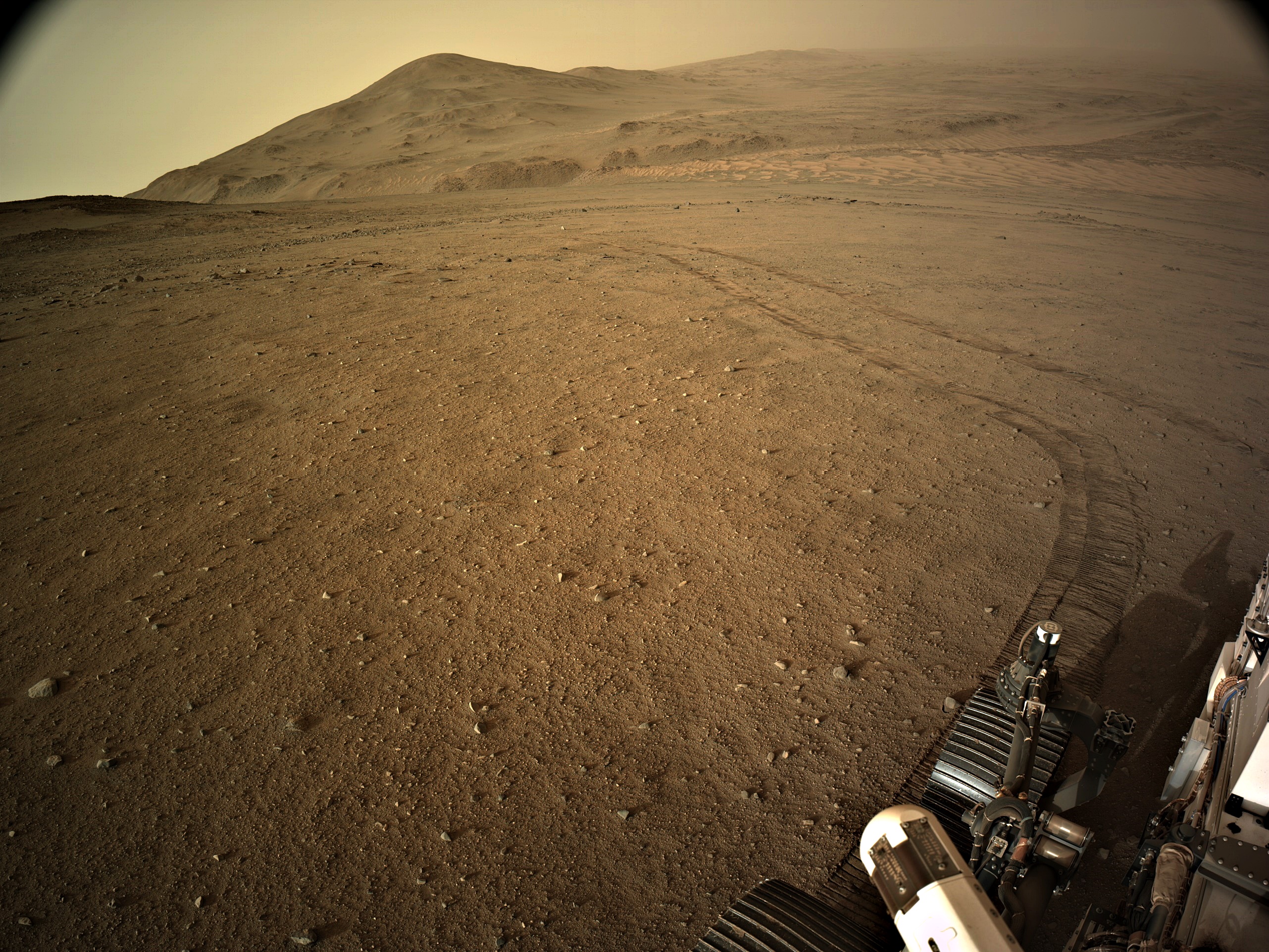
And all the low-lying terrain in this image was under water…
See post (just posted) for the estimated extent of the Paleo Lake : https://lemmy.world/post/19643561
baklava :)
Glad you did :)
Useful link :)
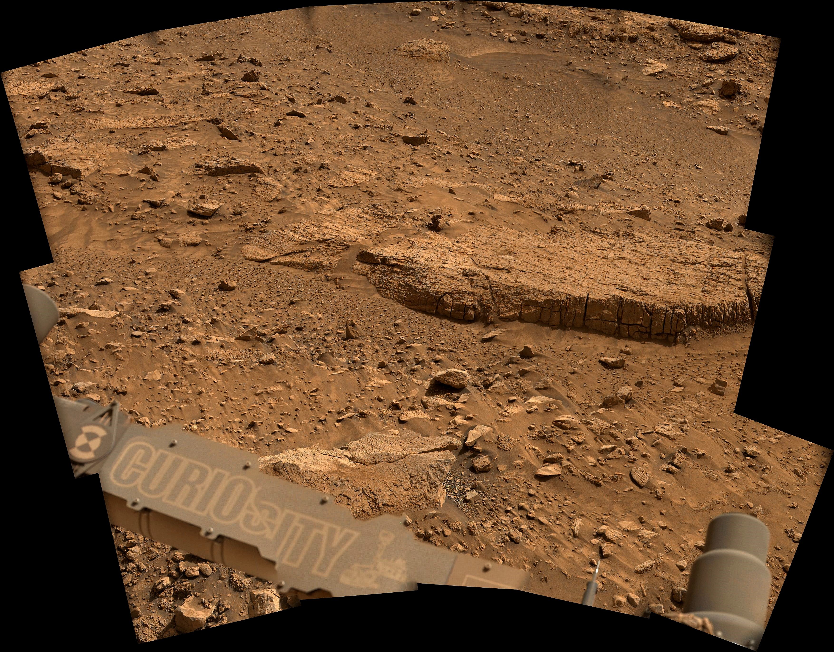
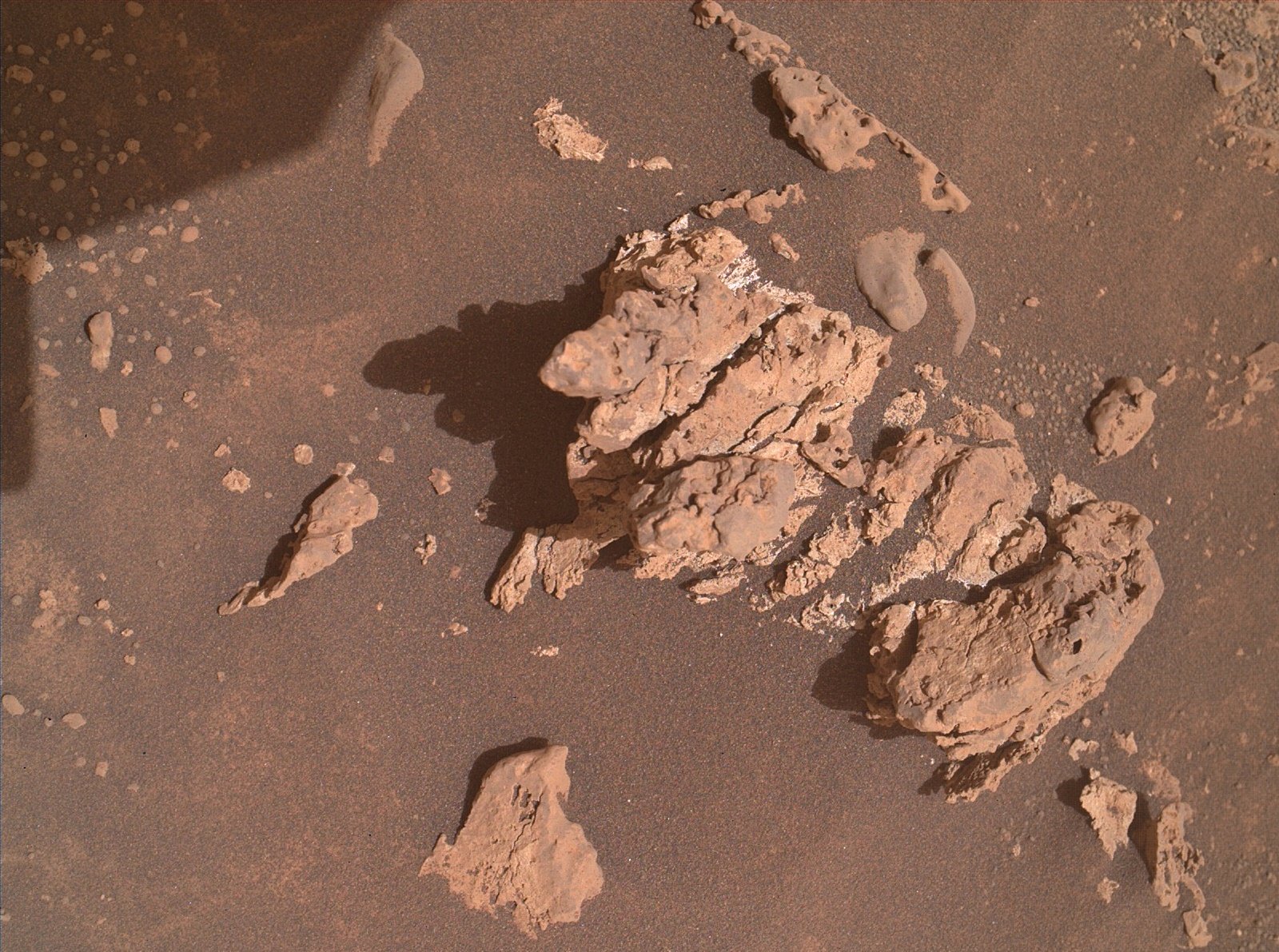
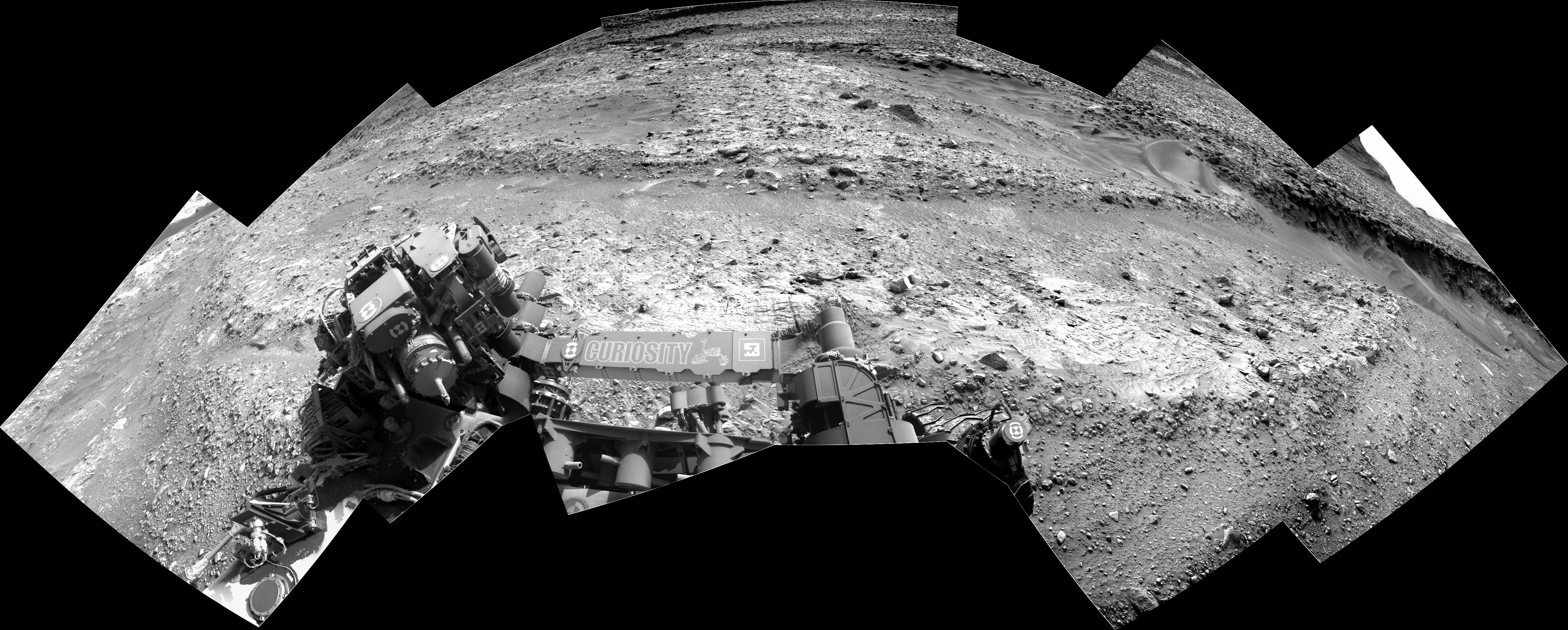
Is that tire patterns in the top left corner?
They are small ripples in the soft sand between rocks, if you look in the NavCam images of the workspace on sol 1254 you can see many more examples.
These ripples are formed by the wind (aeolian process).
Curiosity drove on sol 4287, moving to the north and retracing its path, and is now back at the sol 4251 location.
Here’s a short video clip that goes over the changes https://youtu.be/ov_TXfWBf-4?t=68